Monday, April 30, 2012

ELORA CAVE

The cave temples and monasteries at Ellora, excavated out of the vertical face of an escarpment, are 26 km north of Aurangabad. Extending in a linear arrangement, the 34 caves contain Buddhist Chaityas or halls of worship, and Viharas, or monasteries, Hindu and Jai temples.
Spanning a period of about 600 years between the 5 th and 11 th century AD, the earliest excavation here is of the Dhumar Lena (Cave 29).The most imposing excavation is, without doubt, that of the magnificent Kailasa Temple (Cave 16) which is the largest monolithic structure in the world. Interestingly, Ellora, unlike the site of Ajanta, was never 'rediscovered'. Known as Verul in ancient times, it has continuously attracted pilgrims through the centuries to the present day.
Ellora has been designed as a World Heritage Site, to be preserved as an artistic legacy that will continue to inspire and enrich the lives of generations to come.
Listing of Caves


Buddhist Caves: 5 th century to 7 th century AD
Caves 1 to 12 at the southern end
Hindu Caves: 8 th century to 10 th century AD
Caves 13 to 29 in the middle
Jain Caves: 9 th century to 11 th century AD
Caves 30 to 34 at the northern end
 

AJANTA CAVE

Ajanta and Ellora are the pride of Maharashtra. The rock-cut caves of both these sites are world famous and illustrate the degree of skill and artistry that Indian craftsmen had achieved several hundred years ago. Ajanta dates from 100 B.C. while Ellora is younger by some 600 years. The village of Ajanta is in the Sahyadri hills, about 99 kms. From Aurangabad; a few miles away in a mammoth horseshoe-formed rock, are 30 caves overlooking a gorge, `each forming a room in the hill and some with inner rooms. Al these have been carved out of solid rock with little more than a hammer and chisel and the faith and inspiration of Buddhism. Here, for the Buddhist monks, the artisans excavated Chaityas (chapels) for prayer and Viharas (monasteries) where they lived and taught. Many of the caves have the most exquisite detailed carvings on the walls, pillars and entrances as well as magnificent wall paintings.
These caves were discovered early in the 19th century quite by chance by a party of British Officers on manoeuvres. Today the paintings and sculptures on Buddha’s life, belonging to the more mellow and ritualistic Mahayana Buddhism period, are world famous. Copies of them were shown in the Crystal Palace exhibition in London in 1866. These were destroyed in a fire there. Further copies were published soon afterwards and four volumes of reproductions were brought out in 1933 by Ghulam Yazdani, the Director of Archaeology of the then Hyderabad State. Ajanta has formed an epicentre of interest for those who appreciate and are eager to know more about Indian history and art.
Ajanta Cave     It is a protected monument under the Archaeological Survey of India and has been listed in the World Heritage list of monuments.The 30 caves of Ajanta were created over a span of some 600 years.
In their range of time and treatments they provide a panorama of life in ancient India and are a source of all kinds of information... hair styles, ornaments, textiles, musical instruments, details of architecture, customs etc. It was from this collection of classical Indian art that a particular style was formed that traveled with Buddhism to many parts of the world. Similar paintings can be seen in Sigiriya in Sri Lanka, Bamiyan in Afghanistan, temples and shrines in Tibet, Nepal, China and Japan.

Royal patronage made Ajanta possible. Professional artists carried out much of the work and each contributed his own individual skill and devotion to this monumental work.
Visitors often ask how the artist who painted the detailed frescoes and chiseled out the intricate carvings, managed to work in the dark interiors of the caves. It has been noticed that the caves are illuminated by natural light for part of the day and it is presumed that metal mirrors or sheets of white cloth were used to reflect sunlight into the inner recesses.

Thursday, April 26, 2012

WELCOME TO GOA

‘The Coolest Place in India’


‘Now our road takes us to the magnificent kingdom of Goa…The people of this kingdom are strong, prudent and very hardworking… The kingdom of Goa is the most important in India…It is civilized, having famous orchards and water. It is the coolest place in India and it is the most plentiful in foodstuffs.


‘The white people make a practice of going to the kingdom of Goa to enjoy the shade and the groves of trees and to savour the sweet betel.’


These revealing remarks on Goa come not from the hippies or ‘flower power’ generation of the sixties and early seventies who thronged the beaches of Anjuna, Vagator and Arambol in search of salvation and ‘peace’. These remarks were made over five centuries ago by the Portuguese Ambassador to China who visited Goa around the year 1511. They serve as a vivid precursor to the generations that followed in our times to the fabled land of Goa.


In those tumultuous and rebellious times in the sixties, it was then not the ‘sweet betel’ that was the prime attraction but a different kind of ‘weed’. But Goa, since those days of the angry generation, has moved on to attract a multitudinous, peaceful and cosmopolitan school of visitors from all around the globe.


Down the corridors of time Goa has been different things to different people. To the Portuguese conquerors it was ‘Golden Goa’, the El Dorado, the ‘Rome of the East’. Such was its beauty and grandeur, that a traveller was moved to remark: ‘Whoever has seen Goa, need not visit Lisboa’—Lisbon, which was then the grand epicenter of the Portuguese dominions.

.


Some decades later, the early 17th century French traveller Francois Pyrard wrote: ‘Whoever has been in Goa may say that he has seen the choicest rarities of India, for it is the most famous and celebrated city, on account of its commercial intercourse with people of all nationalities of the East who bring there the products of their respective countries, articles of merchandize, necessaries of life and other commodities in great abundance because every year more than a thousand ships touch there laden with cargo.’


Pyrard continued with near prophetic veracity: ‘…as for the multitude of people, it is a marvel to see the number which come and go every day by sea and land on business of every kind…One would say that a fair was being held every day for the sale of all sorts of merchandise.’


While the contemporary traveller may not come to modern, thriving Goa ‘for the sale of all sorts of merchandise’, the ‘fair’ is still very much on. The traveller is here to find something different: a balm on the busy mind, to enjoy days of freedom on Goa’s


magnificent beaches, to parasail or swim with the tide of fellow visitors from all around the globe, to savour its unique cuisine and imbibe its spirits, to take a long and invigorating trek in its unexplored interiors, to marvel at its majestic temples and churches, in short, to be at one with the most friendly people in the country.


In the sixties and seventies, it was, as we have remarked, a haven for the hippies. Since then Goa has moved on to fullfledged Statehood, its own Council of Ministers, a magnificent new Assembly complex, its citizens among the most literate in the country with a per capita income the highest in the land.. At the hub of this prosperity, is the Tourism industry. At the Goa Tourism Development Corporation (GTDC), we take a humble bow in acknowledgement, in some small measure, of putting Goa on the tourist map of our country.


But we also acknowledge that Goa does not require a massive sales drive.


Goa is a multifaceted jewel in the crown of India.


It is a frame of mind and body, spirit and soul.


Goa is an unfading memory.


It is joy and nirvana.


Goa is India’s smallest State---with the largest heart.


Goa is Forever.

Sunday, April 8, 2012

Lothal


Lothal GujaratSituated at a distance of 80 kms from Ahmedabad, Lothal city is one of the well known cities of the ancient Indus valley civilization. The origin and history of Lothal can be dated back to 2400 BC. Lothal in Gujarat is one of the primary sites of archaeology. Though, it was discovered in the year 1954, but its excavation work began on the February 13, 1955, which continued till May 19, 1960. It was done by the Archaeological Survey of India (ASI). Read on to know more about Lothal in India.

Lothal has enjoyed the status of being the leading center of trade in the bygone times. It was actively involved in the trade of beads, gems and expensive ornaments that were exported to West Asia and Africa. The techniques that were used by the people of this city brought a lot of name and fame to them. People are of the say that, the scientists of Lothal were the ones to initiate the study stars and advanced navigation.

Lothal is very well connected to the Ahmedabad city via road and railways. The archaeological excavations that were carried out led to the finding of a township, dock, mound and a marketplace. Areas lying nearby the excavated sites consist of an archaeological museum, where you can take a look at the various Indus-era antiquities. So, if you have spare time, Lothal is a great destination that can be included in your sightseeing trip of Ahmedabad.

Porbandar

Porbandar is an historically important place. In the 10th centruy it was named as �Pauravelakul� and thereafter named �Sudamapuri�. It is localted at latitude north 21.37o and longitude east 69.49o on the western coast of Saurashtra where the river Asmavati meets the ocean. It has completed one thousand years on Rakshabandhan, full moon day of Shravana, in the Vikram era 2046. In fact, it is believed that Porbandar was discovered on Raksshabandhan day.

Kutch

Kutch district (also spelled as Kachchh) is a district of Gujarat state in western India. Covering an area of 45,652 km²,[1] it is the largest district of India.

Kutch literally means something which intermittently becomes wet and dry; a large part of this district is known as Rann of Kutch which is shallow wetland which submerges in water during the rainy season and becomes dry during other seasons. The same word is also used in the languages of Sanskrit origin for a tortoise and garments to be worn while having a bath. The Rann is famous for its marshy salt flats which become snow white after the shallow water dries up each season before the monsoon rains.

The district is also famous for ecologically important Banni grasslands with their seasonal marshy wetlands which form the outer belt of the Rann of Kutch.

Kutch District is surrounded by the Gulf of Kutch and the Arabian Sea in south and west, while northern and eastern parts are surrounded by the Great and Small Rann (seasonal wetlands) of Kutch. When there were not many dams built on its rivers, the Rann of Kutch remained wetlands for a large part of the year. Even today, the region remains wet for a significant part of year. The district had a population of 1,583,500 of which 30% were urban as of 2001.[2] Motor vehicles registered in Kutch district have their registration Number starting with GJ-12.

Gir Forest

The Gir Forest National Park and Wildlife Sanctuary (also known as Sasan-Gir, ગીર રાષ્ટ્રીય ઉદ્યાન and गिर वन) is a forest and wildlife sanctuary in Gujarat, India. Established in 1965, with a total area of 1412 km² (about 258 km² for the fully protected area (the national park) and 1153 km² for the Sanctuary), the park is located 65 km to the south-east of Junagadh and 60 km to south west of Amreli.

It is the sole home of the pure Asiatic Lions (Panthera leo persica) and is considered to be one of the most important protected areas in Asia due to its supported species. The ecosystem of Gir, with its diverse flora and fauna, is protected as a result of the efforts of the government forest department, wildlife activists and NGOs. The forest area of Gir and its lions were declared as "protected" in the early 1900s by the then Nawab of the princely state of Junagadh. This initiative assisted in the conservation of the lions whose population had plummeted to only 15 through slaughter for trophy hunting.

The April 2010 census recorded the lion-count in Gir at 411, an increase of 52 compared to 2005. The lion breeding programme covering the park and surrounding area has bred about 180 lions in captivity since its inception.

Somnath Temple in Gujrat

Shree Somnath Trust welcomes you to the holy place of the Aadi Jyotirling Shree Somnath Mahadev and the sacred soil from where Bhagvan Shri Krishna took his last journey to his neejdham.


Somnath temple stands at the shore of the Arabian ocean on the western corner of Indian subcontinent in Gujarat State. This pilgrimage is one of the oldest and finds its reference in the ancient texts like Skandpuran, Shreemad Bhagavat, Shivpuran etc. The hymn from Rig-Veda quoted below mention the Bhagvan Someshwar along with the great pilgrimage like Gangaji, Yamunaji and Eastward Saraswati. This signifies the ancient value of this Tirthdham.

Somnath is in Prabhas Patan very near to Veraval. 


The Moon God is said to have been relieved from the curse of his father-in-law Daksha Prajapati by the blessings of Bhagvan Somnath.  In  the Shiva  Purana  and Nandi  Upapurana, Shiva  said, `I  am  always present everywhere  but  specially  in  12  forms  and places as  the  jyotirlingas`. Somnath is one of  these 12 holy places. This is the first among the twelve holy Shiva Jyotirlings.


The  shore  temple of Somnath is  believed  to  have  been  built  in  4  phases-in  gold  by  Lord Soma,  in  silver  by  Ravi,  in wood  by  lord  Krishna  and  in  stone  by  King Bhimadeva.


It has withstood the six-repeated desecration by the Muslim invaders. The very existence of this temple is symbol of reconstructive spirit and cultural unity of our society.

The seventh existing temple is built in the Kailas Mahameru Prasad style. The Iron man of India Sardar Shri Vallabhbhai Patel is the pioneer of the existing temple.


The temple is consisting of Garbhgruh, Sabhamandap and Nrityamandap with a 150 feet high Shikhar.

The Kalash at the top of the Shikhar weighs 10 tons and the Dhwajdand is 27 feet tall and 1 foot in circumference. The Abadhit Samudra Marg, Tirsthambh (Arrow) indicates the unobstructed sea route to the South Pole. The nearest land towards South Pole is about 9936 km. away. This is a wonderful indicator of the ancient Indian wisdom of geography and strategic location of the Jyotirling. The temple renovated by Maharani Ahalyabai is adjacent to the main temple complex.


Hari Har Tirthdham is here in Somnath. This is the holy place of Bhagvan Shri Krishna's Neejdham Prasthan Leela. The place where Bhagvan Shri Krishna was hit by an arrow of a poacher is known as Bhalka Tirtha. After being hit by the arrow, Bhagvan Shri Krishna arrived at the holy confluence of Hiran, Kapila and Saraswati and their Sangam with the ocean. He performed his divine Neejdham Prasthan Leela at the sacred and peaceful banks of river Hiran.


The Geetamandir is built here where the divine message of Shrimad Bhagavat Geeta is carved on eighteen marble pillars. Shri Lakshminarayan Mandir is close by. The Balramjiki Gufa is the place from where Bhagvan Shrikrishna's elder brother Balaramji took journey to his nijdham-patal.


Here is the Parshuram Tapobhumi, where Bhagvan Parshuramji carried out penance and he was relieved from the sin of Kshatriya killings. The Pandavas have said to have visited this place and taken holy bath in the Jalprabhas and built five Shiv temples.


 The Somnath Trust has endeavored to develop the whole Shri Krishna Neejdham Prasthan Tirtha in an wholesome manner. The pilgrims please contribute generously to this noble cause.

NAINITAL

Area:      11.73 kms.
Population:      32800,
Altitude:      1,929 ill.
Tempertature:      Summer 10.6° c to 26.7° c.
Rainfall :      Average 2794 mm.

Best season to visit:
     Mar to Jun and Sep to Oct
Language Spoken:      Hindi, English and Kumaoni.


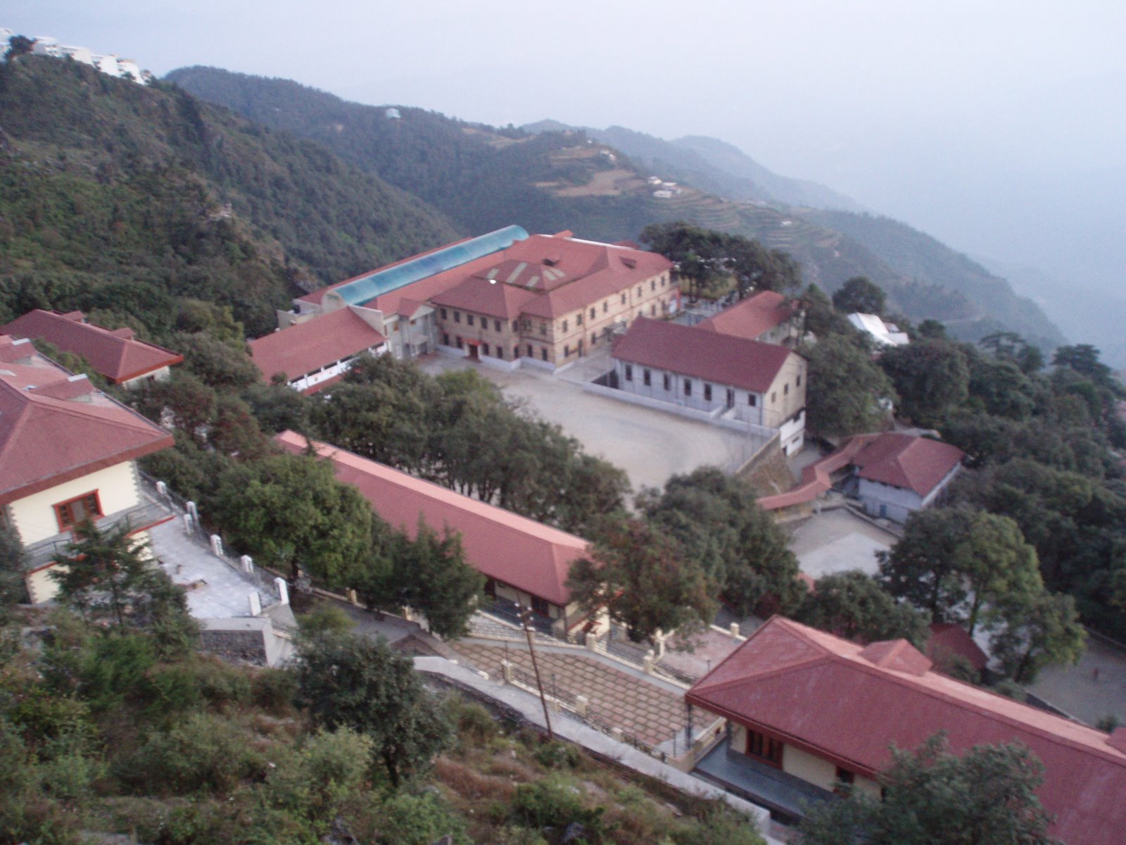
Nainital - The beautiful lake resort nestles amidst seven hills in a lush valley at an altitude of 1938 metres. In 1841, the British first discovered Nainital as a holiday resort. Today, the town has emerged as one of the most important hill resorts of India

Nainital is a modem hill resort of northern India (336 kms from Delhi) connected  by best-aligned and maintained roads from the railhead of Kathgodam. Railway line was laid upto Kathgodam in 1882. The road passes through forests where occasionally wild animals can also be seen. "Naini" is derived from the temple of goddess Naini which was built on the bank of the lake but later got destroyed due to land slides in the year 1880, The place is mentioned in Skand Puran as 'Trishul Sarover'. Tri Rishi (three sages Atri, Pulastiya and Pulha) had come there for pilgrimage while they were at Gagar range (now called China Peak), they felt thirsty and could not find any water. Thereafter, they thought of Man Sarover and dug a hole which at once got filled with water.


The lake then formed was called Tri-Rishi Tal (The lake of three sages). Today it has an impressive lake surrounded by the hills from three sides with highest peak Cheena (2610 m) and the valley in between running from east to west. The lake is a little more than 3 kms in circumference.
Nainital remains packed from April to November with tourist for sight seeing as well as for seeking escape from the heat of the plains. Naini lake has facilities for boating and yatching. Facilities for horse riding, skating, golf and rock climbing are also available for the visitors. Fishing is also permitted with the permission of local authorities. Talli Tal and Malli Tal are the two main trading centre at Nainital


How to Reach
Air: Nearest airport is at Pantnagar (71 kms), connected by air service with New Delhi.

Rail: The nearest railway station is Kathgodam (35 kms).

Road: Nainital is well connected with all major cities in northern India.


What to See Around

Hanumangarhi : (1, 951 m) 3 km. A popular place for worship in the temple of lord Hanuman and its Sun-set view.

Khurpatal : (1,635 m) 5 to 10 kms. This is an angler’s paradise on Nainital-Kaladhungi-Ramnagar Road. It is here that the conifers belt merges and gives way to the Sal trees. Fishing permits are available from Deputy Commissioner, Nainital.

Kilbury: (2,194 m) 10 kms. A wooded spot, ideal for a quiet and peaceful holidays, which is connected by road.

Lariakanta : (2, 481 m) 6 kms. This is the second highest peak of Nainital and commands a glorious view of the lake region.

Land's End: (2,1l8 m) 4.08 kms. One can have magnificent view of Khurpatal and the terraced fields on the hill side.

Naini Peak: (2,611 m) (Cheena Peak) 6 kms. Most favoured picnic spot of the town. One can view the distant plains and snow clad Himalayas from the peak. A bird's eye view of the lake is also obtainable from here. One can either trek or go on a horse back upto Naina Peak.

Naini Lake: The boat club overlooking the lake offers sailing facilities and also boating. Fishing is allowed with the permission of Executive Officer, Municipal Board, Nainital.

Snow-View: (2270 m). 3 km. This is the nearest easily accessible peak on Sher-ka-Danda hill connected by Ropeway. A powerful telescope is fixed here which enables one to view the Himalayan ranges.

Nainital Ropeway : Kumaon Mandal Vikas Nigam has since installed the most sophisticated ropeway at Nainital which is the first of its kind in India. The ropeway covers a distance of 705 metres with an altitude gain of 300 metres. Carrying a maximum load of 825 kgs or 12 persons in each of its two cars, the ropeway travels at a maximum speed of 6 mts/ sec.

Bhimtal : (1,371 m) 22 kms away from Nainital. Bhimtal is named after Bhim, one of the five Pandavas of 'Mahabharata'. The lake at Bhim Tal is larger than Naini lake at Nainital. Boating, swimming and fishing are the main attractions. An island in the centre of the lake is an excellent spot for picnic. Fishing permits can be obtained from the fishing Inspector of Bhim Tal. Tourist Bungalow and private lodges are available here.

Naukuchia Tal: (1,219 m) 27 kms.This is a lake known for its nine comers. Area around the lake is an ideal place for bird watching. Fishing permits can be obtained from Fishing Inspector of Bhimtal.

Sat Tal: (1371 m) 21 kms. away from Nainital. This is a charming spot and the venue of the famous Kohinoor Camp in summer. There is an Ashram run by Dr. E. Stanley Jones of United States Missionaries, where religious, educational and social youth camps are held every year. Nearby, there are several small lakes, numbering seven, from where the name Sat Tal is derived. The lakes include Panna, Nal Damyanti and Sita. Sukha Tal is located in the middle of thick pine and oak trees. There are excellent facilities for swimming, boating and fishing. A small World Life sanctuary is another spot of tourist attraction.

MUSSOORIE

Mussoorie, the queen of the hills, is one of the most popular and fascinating hill resort of northern India. Its green hills and varied fauna and flora make it a colourful and picturesque hill station, commanding a wonderful view of extensive Himalayan snow ranges to the North-East, and Panoramic view of the Doon valley to the south.


The place came to be known as Mussoorie due to unlimited growth of a bush locally known as Mussoorie. The town presents fairyland atmosphere to the tourists. Its history dates back to 1811 when the place was purchased by an European Major Hearsey from the local land lord. Later he sold it to the East India Company in the year 1812. In 1812, the next-door township of landour was made a sanitorium and convalescent depot for troops. In 1827 Captain Young, an adventurous British Army officer, explored the present site and laid the foundation of this holiday resort with the opening of shooting box on Landour hills. In 1832 Col. Averest then Surveyer General of India opened his office in Mussoorie. In 1880, it became the residence of Afghan detenue Yakub Khan, the Ex-Amir of Afghanistan for summer with winter residence in Dehradun. However, later it remained the summer residence of their Royal Highness, the Duke and Duches of Conn aught. Development of Mussoorie started after rail link was established between Haridwar and Dehradun in 1890.

General Information
Area: 64.25 Sq. km. Population. 16323 (1981 census). Altitude: 20002400 m.


Temperature: Summer 7.2 C to 31.7 C and Winter 1.0 C to 7.2 C Rainfall. Max in Aug. 764.9 mm to Min in Nov. 5.1 mm

Clothing: Summer-Light Woollen and Winter: Heavy Woollens.
Language spoken: Hindi, English and Garhwali.

Best season to visit: March to July and September to October.

What to see in Mussoorie
Sir George Everest's House:
Municipal Garden (4 kms) :
Camel's Back Road (3 km.) :
Kempty Fall:
Lal Tibba (5 Km) :

Places around Mussoorie

Yamuna Bridge:
Nag Tibba :
Dhanolti :
Surkhanda Devi :

How to Reach Mussoorie
Air: Jolly Grant Airport Dehradun is the nearest Airport for reaching Mussoorie (24 kms). Air Deccan and Kingfisher Airlines operate daily flights to Dehradun from New Delhi

Rail: Nearest Railhead is Dehradun (35 kms) which is directly connected with Delhi, Mumbai, Gorakhpur, Kathgodam, Varanasi, Howrah, Rishikesh and Haridwar. Taxis are available from Dehradun railway station to Mussoorie

Road: Mussoorie is connected by regular bus services to all the major centers of tourist interest in the region. Direct buses are also available for Muussoorie.


http://adf.ly/Brm0h http://adf.ly/6nPii